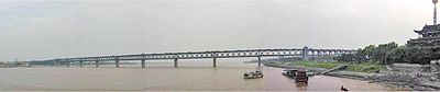
The Yangtze flows into the East China Sea and was navigable by ocean-going vessels up a thousand miles from its mouth even before the Three Gorges Dam was built. As of June 2003, this dam spans the river, flooding Fengjie, the first of a number of towns affected by the massive flood control and power generation project. This is the largest comprehensive irrigation project in the world and has a significant impact on China's agriculture. Its proponents argue that it will free people living along the river from floods that have repeatedly threatened them in the past and will offer them electricity and water transport—though at the expense of permanently flooding many existing towns (including numerous ancient cultural relics) and causing large-scale changes in the local ecology.
Opponents of the dam point out that there are three different kinds of floods on the Yangtze River: floods which originate in the upper reaches, floods which originate in the lower reaches, and floods along the entire length of the river. They argue that the Three Gorges dam will actually make flooding in the upper reaches worse and have little or no impact on floods which originate in the lower reaches. Twelve hundred years of low water marks on the river were recorded in the inscriptions and the carvings of carp at Baiheliang, now submerged.
The Yangtze is flanked with metallurgical, power, chemical, auto, building materials and machinery industrial belts and high-tech development zones. It is playing an increasingly crucial role in the river valley's economic growth and has become a vital link for international shipping to the inland provinces. The river is a major transportation artery for China, connecting the interior with the coast.
The river is one of the world's busiest waterways. Traffic includes commercial traffic transporting bulk goods such as coal as well as manufactured goods and passengers. Cargo transportation reached 795 million tons in 2005. River cruises several days long, especially through the beautiful and scenic Three Gorges area, are becoming popular as the tourism industry grows in China.
Flooding along the river has been a major problem. The rainy season in China is May and June in areas south of Yangtze River, and July and August in areas north of it. The huge river system receives water from both southern and northern flanks, which causes its flood season to extend from May to August. Meanwhile, the relatively dense population and rich cities along the river make the floods more deadly and costly. The most recent major floods were the 1998 Yangtze River Floods, but more disastrous were the 1954 Yangtze River Floods, killing around 30,000 people. Other severe floods included those of 1911, which killed around 100,000, 1931 (145,000 dead), and 1935 (142,000 dead).


 The Yangtze is home to at least three critically endangered species: The Chinese Alligator, the Finless Porpoise and the Chinese Paddlefish. (This is the only other place besides the U.S. that is native to an alligator species.) The Finless Porpoise were counted in 2010 to be 1000 exemplars. More species have become extinct in the Yangtze than in any other river in China. This is due to commercial use of the river coupled with tourism and pollution. In December 2006, the Baiji (Chinese River Dolphin) was declared functionally extinct after an extensive search of the river revealed no signs of the dolphin's inhabitance; however, one was sighted soon after.